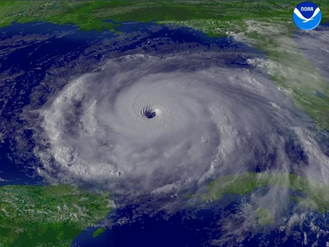
Summer 2022 started with predictions of a busier than usual hurricane season for the seventh straight year. So far, the season has produced fewer storms than predicted. The slow pace of hurricanes has left experts questioning why.
The National Oceanic & Atmospheric Administration (NOAA) said before the start of the season that the outlook for the 2022 season predicts a 65% chance of an above-average season.
The season, which traditionally starts Jun. 1 and ends Nov. 30, produced no named storms until September. NOAA forecast 14 to 21 named storms, between three to six as major hurricanes. Hurricane Fiona, which just shut down the electrical grid in Puerto Rico and lashed the Dominican Republic, is expected to move north in the Atlantic Ocean,
Hugh Willoughby is a research professor at Florida International University who studies hurricane dynamics. Willoughby also has more than four decades of experience including observing hurricanes for the Navy and NOAA.
When discussing the strange hurricane season this year Willoughby said, “there’s been a lot of unusual weather worldwide, droughts in Europe, floods in Pakistan, droughts in China, fires in California, and floods in the Eastern US.”
One theory that could explain the tepid hurricane season is the displacement of troughs, Willoughby said. Troughs are prime areas where thunderstorms may form.
“What I think is that position, and those troughs all around the globe, have changed from where they stayed most of the time. And that could be just a random change, or could be a sign of global warming.”
A change in trough location can lead to a change in where a storm can develop.
But this hurricane season has other factors that may be causing this slow start. Per Space.com, another possible factor may be the Saharan dust that has moved over the Atlantic Ocean towards the east coast of the United States.
Another factor cited by meteorologists is Saharan dust. Willoughby said the dust keeps storms from forming and has contributed to the slower season. The dust brings with it dry air which weakens the chance of a storm.
The Saharan dust is not an anomaly. According to NASA, approximately 182 million tons of dust leave Africa every year. This year the amount of dust has been above-average.
“The big control over Atlantic hurricane activity is El Niño, when that happens is when the cold currents off the east coast of North America, and particularly South America, are warmer than normal. That gives you more shear over the Atlantic and makes it an active season,” said Willoughby.
But this year the currents have been colder than normal, said Willoughby.
But the season is not over and still has more than two months left. And we have seen an uptick of named storms, including Fiona.
Willoughby expressed his caution by noting, “Well, it ain’t over till it’s over. The other thing is the example of (Hurricane) Andrew, which [formed during] an utterly unremarkable hurricane season. Except for everybody in Miami’s backyard. And if the wind blows 100 miles in my backyard, it’s not an inactive season.”


